Eyeing a Lake Washington waterfront lot in Madrona or Denny Blaine? The right parcel can unlock a signature estate, but shoreline rules, moorage limits, and slope conditions can change the numbers quickly. You want clarity before you invest time or capital. This guide walks you through what controls feasibility, how dock rules really work, and the due‑diligence steps that keep your project on track. Let’s dive in.
What drives feasibility on Lake Washington lots
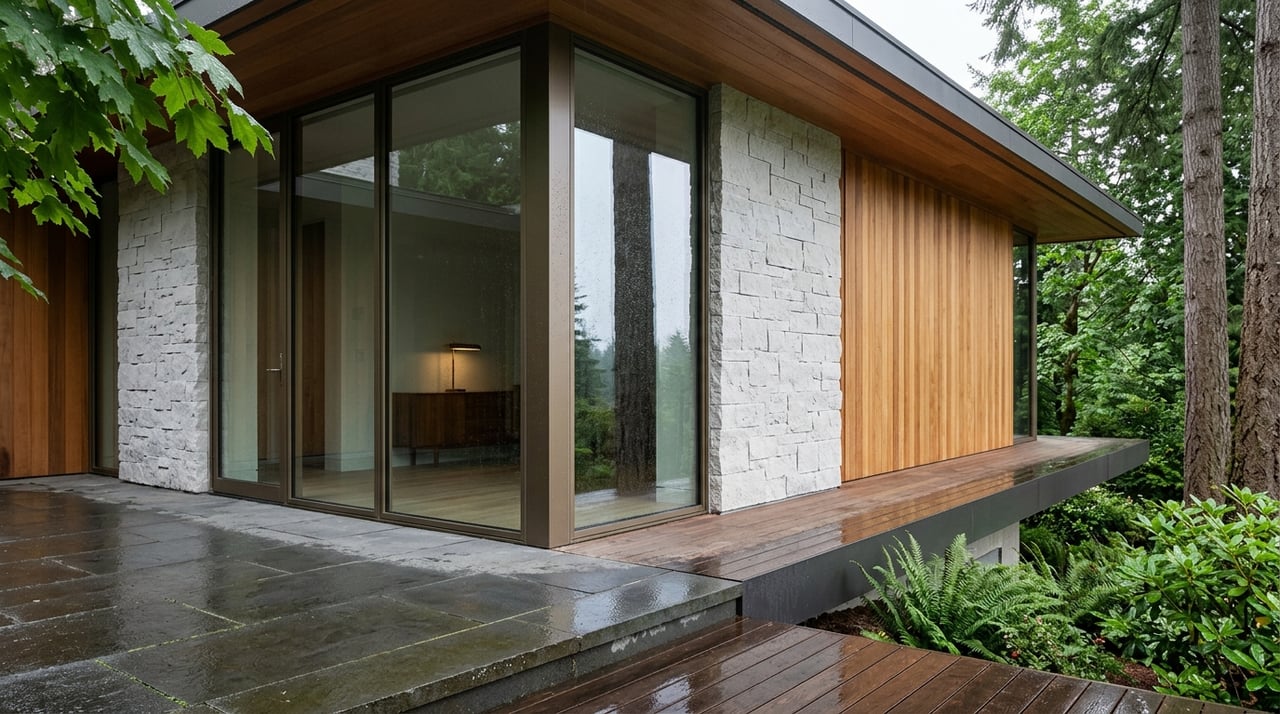
Every waterfront site starts at the waterline. In Seattle, the Shoreline Master Program (SMP) in SMC 23.60A sets what you can do near and over the water. It defines the standards for piers, floats, setbacks, and how lot width is measured at the ordinary high water mark (OHWM). For the exact rules and measurement methods, review the City’s SMP ordinance text in SMC 23.60A.
The lot width at the OHWM is a make‑or‑break number for moorage. Seattle measures width as the straight line between where the side lot lines meet the OHWM. If your width is under certain thresholds, you may be limited to a shared pier or other moorage options. Always confirm width with a survey that ties to the OHWM, then check what the SMP allows for your shoreline environment.
Madrona and Denny Blaine include many steep and terrace‑like parcels. If your lot includes mapped steep slope or landslide‑prone areas, the City applies Environmentally Critical Areas (ECA) rules. That often means a geotechnical report, limits on grading, and specific foundation guidance. Start by reading SDCI’s overview of the Environmentally Critical Areas code.
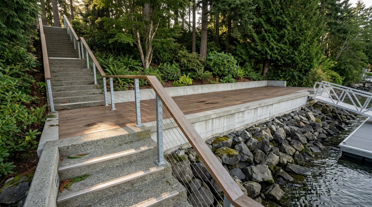
Flood‑prone edges and older seawalls also matter. Replacing or repairing shoreline stabilization can require multiple permits and biological review. Vegetation and habitat are another layer. The “no net loss” standard applies, so projects that affect nearshore habitat or shading will face higher scrutiny and mitigation.
Finally, check for easements and adjacency to public access. Portions of the Madrona–Denny Blaine edge include public parks and shoreline paths. Recorded dedications or public stairs near your lot can limit private shore‑work and influence moorage layout. Plan to review recorded documents early in your process.
How Seattle regulates waterfront work
Most work within the Shoreline District requires a Shoreline Substantial Development Permit or a shoreline exemption. Shoreline jurisdiction generally includes land within 200 feet of mapped shorelines. SDCI outlines the process, typical submittals, and when conditional uses or variances apply on its shoreline land use permit page.
If you touch the water or lakebed, you will coordinate with state and federal agencies too:
- Washington Department of Fish and Wildlife issues a Hydraulic Project Approval for work that changes the bed or flow of state waters, including docks and shoreline stabilization.
- Washington Department of Natural Resources manages many aquatic beds and can require an aquatic lands lease or authorization if your moorage occupies state‑owned lakebed.
- The U.S. Army Corps of Engineers may review projects under federal law. Many small residential moorage projects can use nationwide permits, but plan to confirm scope with the Seattle District’s regulatory FAQ.
Dock and moorage basics in Madrona and Denny Blaine
Private vs. shared piers
For single‑family freshwater lots, the SMP allows accessory residential piers under specific conditions designed to reduce habitat impacts. Your lot width at the OHWM and the shoreline environment designation determine whether an unshared pier is allowed or if a shared/joint pier is required. Where lots are narrow, shared moorage is common. For the exact width thresholds and proximity tests, rely on the standards in SMC 23.60A.
Design constraints to expect
Seattle’s shoreline standards are written to minimize overwater coverage and shading. Covered or enclosed residential moorage is generally prohibited. Overwater elements are kept short and light‑permeable where feasible. The code includes a 100‑foot length rule for most freshwater piers, with exceptions only where other moorage options are impracticable. Expect biological review to verify that your design avoids eelgrass, forage‑fish areas, and key shallow‑water habitat.
Multi‑agency timeline
Plan for a coordinated sequence: city shoreline review, then state HPA, then DNR if a lease is needed, and federal review if applicable. SDCI notes that routine multi‑agency packages can take about three to six months or longer depending on scope and habitat issues. The City outlines shoreline permit steps and pre‑application options on its shoreline permit page. Early contact with agencies helps you scope studies and avoid redesign.
When buoys or no‑dock outcomes make sense
On some lots, shared moorage or a mooring buoy can be a better ecological and regulatory fit than a new pier. Narrow width, sensitive habitat, or adjacency to public access may point you there. The SMP is the arbiter, so your survey and habitat assessment should drive this decision.
Redevelop or preserve? How codes shape value
Waterfront parcels here are typically zoned single‑family, but the shoreline overlay adds its own height, setback, and coverage limits. If you plan a teardown or a major addition, expect a fuller land‑use and ECA review. Large increases in footprint, grading, or impervious area will draw attention to slope stability, drainage, and vegetation.
Older boathouses, seawalls, and stairs are sometimes legal nonconforming. You may be able to repair or alter them with permission, but not necessarily expand them as‑is. Pull the permit record and any historical notes before you budget for preservation or replacement.
The biggest variable on steep sites is often geotechnical mitigation. If you are in mapped steep‑slope or landslide‑prone areas, specialized foundations, retaining systems, and stabilization can be significant cost drivers. SDCI notes that steep‑slope development relief may not apply on some waterfront lots, so do not assume a variance exists. Review the City’s guidance on ECA and grading permit submittals and include a geotechnical scope in your feasibility budget.
Tree protection and shoreline vegetation rules will also influence layout. Expect to submit planting and buffer enhancement plans when you alter shoreline vegetation. Factor both installation and long‑term maintenance into your project pro forma.
Step‑by‑step due diligence checklist
Use this sequence to vet a lot before you offer or design:
Confirm parcel basics. Pull the assessor record to verify parcel ID, legal description, year built, and existing improvements using King County eReal Property. Note any tax flags and cross‑check the site address and waterfront frontage description.
Search for recorded encumbrances. Review deeds, easements, covenants, shoreline dedications, and plats. Look for language about public access, park dedications, or view easements that could constrain shore‑work.
Pull the permit and enforcement history. Use SDCI’s online research tools, including the Shaping Seattle map, to identify prior shoreline permits, pier authorizations, or enforcement cases. Older records may be in microfilm.
Map ECA and shoreline layers. Display steep slope, landslide risk, buffers, and flood‑related layers on the County and City viewers. The King County iMap viewer is a fast way to get a first look at constraints.
Commission a survey tied to OHWM. You cannot answer moorage feasibility without it. The SMP’s lot‑width test uses the OHWM line, so your surveyor should locate it or show a defensible tie for SDCI review.
Order technical reports. At minimum, plan for: a topographic and shoreline survey, a geotechnical report focused on slopes and shoreline soils, and a biologist’s shoreline assessment if you propose overwater work or buffer alterations. If significant trees are present, add an arborist report. SDCI lists typical grading permit submittal expectations, which often align with shoreline packages when earthwork is involved.
Hold a pre‑application meeting and early agency calls. SDCI’s shoreline team can confirm what permits apply and which studies are required. If you plan a dock, contact WDFW about the HPA process, DNR about a potential aquatic lease, and the Corps using the Seattle District’s regulatory FAQ.
Build a realistic schedule. Many residential moorage packages take three to six months or more for multi‑agency review. SDCI outlines shoreline permitting steps and timing on its shoreline permit page. Coordinate consultant work so studies are complete before you submit.
Madrona and Denny Blaine cues to watch
- Park adjacency. Portions of the shoreline near Madrona Park and Denny Blaine Park include public access points. If a public staircase or dedicated strip runs near your lot, expect added scrutiny of private shore‑work and moorage.
- Historic terraces and seawalls. Many parcels step down to the water over older masonry or concrete elements. Replacements can trigger habitat mitigation and multi‑agency review, so document condition early.
- Narrow frontage segments. Curving shoreline and irregular plats can yield less width at the OHWM than the street‑side width suggests. Confirm lot width at the OHWM with a survey before you model a private pier.
- Nonconforming structures. Older boathouses and overwater features may be legal nonconforming. Permit history is your best evidence of what exists and how it can be repaired.
Bringing it together
If you plan to build or significantly renovate on the Madrona or Denny Blaine shoreline, start with the waterline facts. The SMP governs your options, lot width at the OHWM decides moorage direction, and ECA flags shape the cost of foundations and grading. With a clean survey, the right technical reports, and early coordination across City, state, and federal agencies, you can move from concept to permits with fewer surprises.
If you want a confidential, senior‑level perspective on a specific parcel, reach out. As a boutique, principal‑led waterfront advisor, Patricia Wallace connects clients with the right technical team, reads the shoreline quickly, and positions you for a smooth acquisition and build.
FAQs
What permits do you need for a new dock on Lake Washington in Seattle?
- Most projects require a City shoreline permit, a state HPA from WDFW, a DNR aquatic authorization if your structure uses state‑owned lakebed, and often a federal authorization from the U.S. Army Corps of Engineers.
How do you know if a private pier is allowed on a Madrona or Denny Blaine lot?
- Measure lot width at the OHWM with a certified survey, then apply the SMP’s width and design standards. Narrow lots often require shared moorage or alternatives.
What adds the most cost on steep waterfront sites in Seattle?
- Geotechnical mitigation for steep slopes and landslide‑prone areas, seawall work with mitigation, and required habitat and vegetation plans typically drive cost and schedule.
How long does multi‑agency review usually take for residential moorage on Lake Washington?
- Routine packages can take about three to six months, with longer timelines for complex designs or sensitive habitat.